


 38 / 218

against natural hazards. The program combines innovative
technologies with appropriate applications and partnerships
at the community level in order to ensure that the networks it
creates serve the all a community’s information needs.
Community ownership and partnership is the core principle
of RANET’s sustainability strategy.
RANET uses web content broadcast over satellite radio from
global and national information providers. This is then linked
to solar-powered community radio stations and community
information centres. Other techniques include wind-up radio
receivers, email via satellite and HF radio. Community weather
stations promote interest and ‘ownership’ of weather and
climate information.
RANET first started in Africa, and has now spread to Asia
and the Pacific Islands, where it is a key part of emergency
management systems. While none of the technologies is
uniquely successful, combined they are highly effective and
valued by communities. RANET’s strategy is to work with a
variety of NGO and government information producers. This
is a holistic approach to sustainability and disaster reduction.
While weather and climate information is important, RANET
recognizes that there are often more immediate needs at the
community level.
4
Media weather presentation
A perfect weather forecast is of little use if it is not communi-
cated to the appropriate people. TV is one of the most effective
ways of communicating to a wide variety of people quickly and
in a way that is easily understood. Local TV companies operate
in almost every country, and as the cost of satellite TV broad-
casting has fallen, they can now reach beyond the urban
population. Providing information in local languages is impor-
tant; often, national broadcasters will have schedules for each
of the national language groups, and targets for locally-
provided content.
TV weather presentation studios have been provided to the
NMHS of about 35 developing countries. These use equipment
which is carefully selected to give a high quality TV image
without the flexibility and expense needed in the usual TV
studio. Having the studio in the NMHS, and providing the
broadcast to the TV company on tape means that the forecaster
has editorial control of the content, thus ensuring that the
presentation is clear and correct.
Observations
Support for observations was the starting point for WMO VCP.
Many recent projects have focused on the change to digital
radio-sondes for upper air soundings, along with replacing or
upgrading ground equipment. Each observation uses a radio-
sonde and balloon, which cost approximately USD200. A
station meeting the full recommendation will launch two per
day. Many stations use hydrogen as the lifting gas in balloons,
the generators of which are expensive, but do have a long life.
Automatic weather stations, especially those which have
manual input of data such as cloud type, are becoming more
widely used, giving more surface observations especially at
night. Systems for communicating the observations are also
supported by VCP, and email and cell phone communications
are becoming widely used.
There are a small number of stations with further specialised
equipment, such as the solar photometer installed with support
from Spain at Tamanrasset, southern Algeria for monitoring
desert aerosols and dust.
Over a long period, VCP support for climate database
management systems on PC has been very useful. The
CLICOM system originally developed with USA support was
widely used, and replacement systems are being imple-
mented with support from many VCP partners. In particular,
the Climsoft system was developed in the NMHS of
Zimbabwe, Kenya and Guinea with support from the UK and
Australia.
As awareness of climate change increases, there are projects
to digitise old data in paper archives using digital photogra-
phy, and subsequent conversion to climate databases.
[
] 38
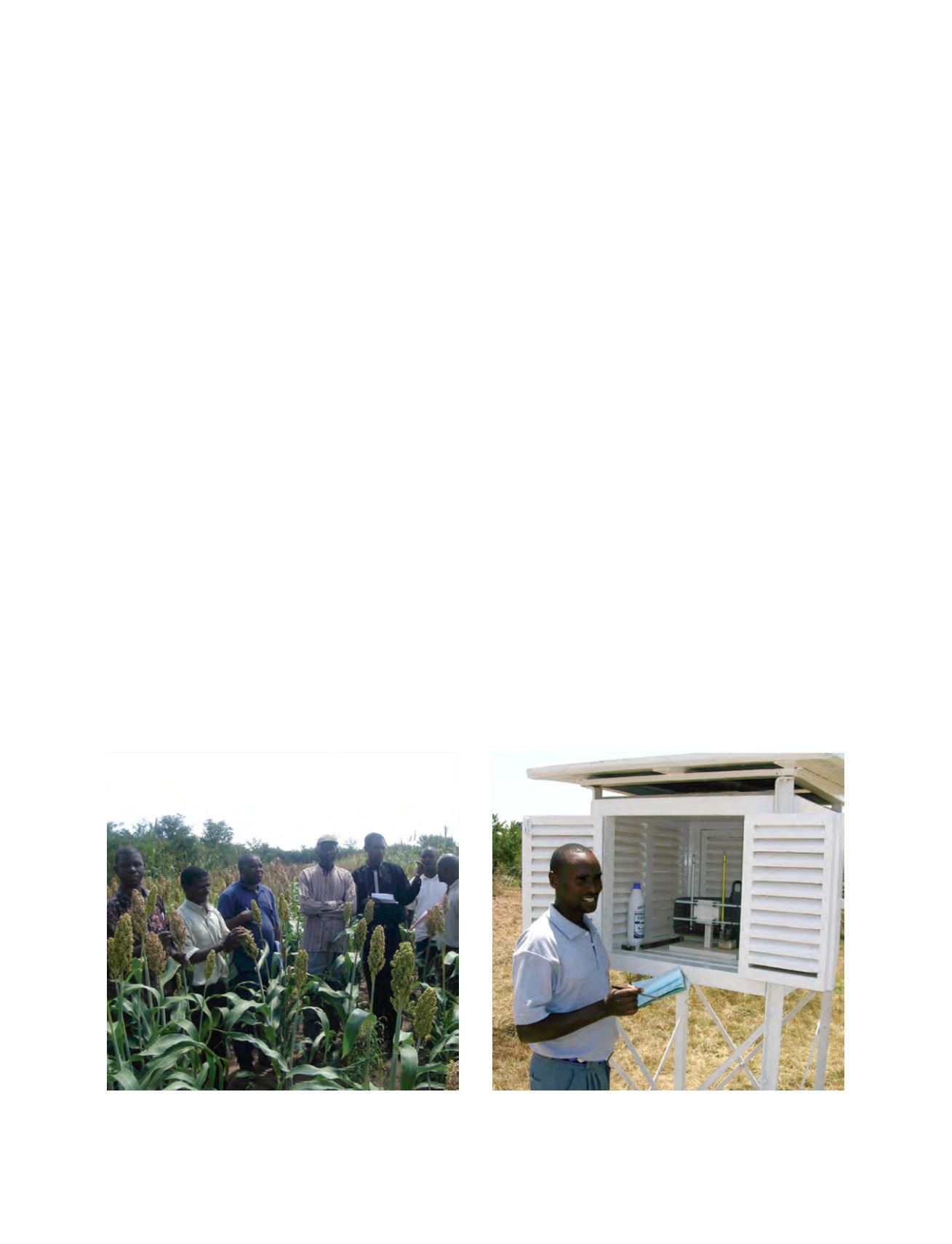
Participants in the e-SIAC training engaging with farmers and
agricultural extension workers in Southern Zambia about information
products
Photo: Care, Zambia
An observer at the surface station at Narok, Kenya. Kenya Met. Dept.
have pioneered a project to distribute information products to
communities using their local observers
Photo: Met Office, UK