


 137 / 156

[
] 137
include global positioning system (GPS); InSAR; digital-
elevation models and landscape evolution.
The UK also supports work within the international Integrated
Global Observing Strategy (IGOS) initiative. As part of the activ-
ities of the IGOS partnership, the British Geological Survey
(BGS) co-chairs an IGOS GeoHazards theme with the French
Geological Survey and the ESA. This strategy for geohazards
observations is focused on pre-disaster mapping, monitoring
and mitigation for earthquakes, landslides, subsidence and
volcanoes. Its goal is to improve global society’s preparedness,
so that known hazards do not turn into disasters. The IGOS
GeoHazards Theme Report was published by ESA in April 2004.
ESA and the French Geological Survey are implementing the
theme through a jointly established executive bureau. The UK, with
the other two co-chairs, sits on the theme’s steering group, along-
side the United States Geologic Survey, UNESCO, ESA, NASA and
JAXA for the space agencies, and representatives of the global
seismic, geodetic, landslide and volcano observatory communities.
Following an international geohazards workshop held in June
2005, five working groups have been established and an active
network of scientists and other interested parties is being devel-
oped, called GeoHazNet. This network will form the basis for a
disaster-related Community of Practice within the GEO initia-
tive. GeoHazNet membership will be open to individuals,
projects and institutes and is being promoted via a series of
regional workshops. The second main task being undertaken
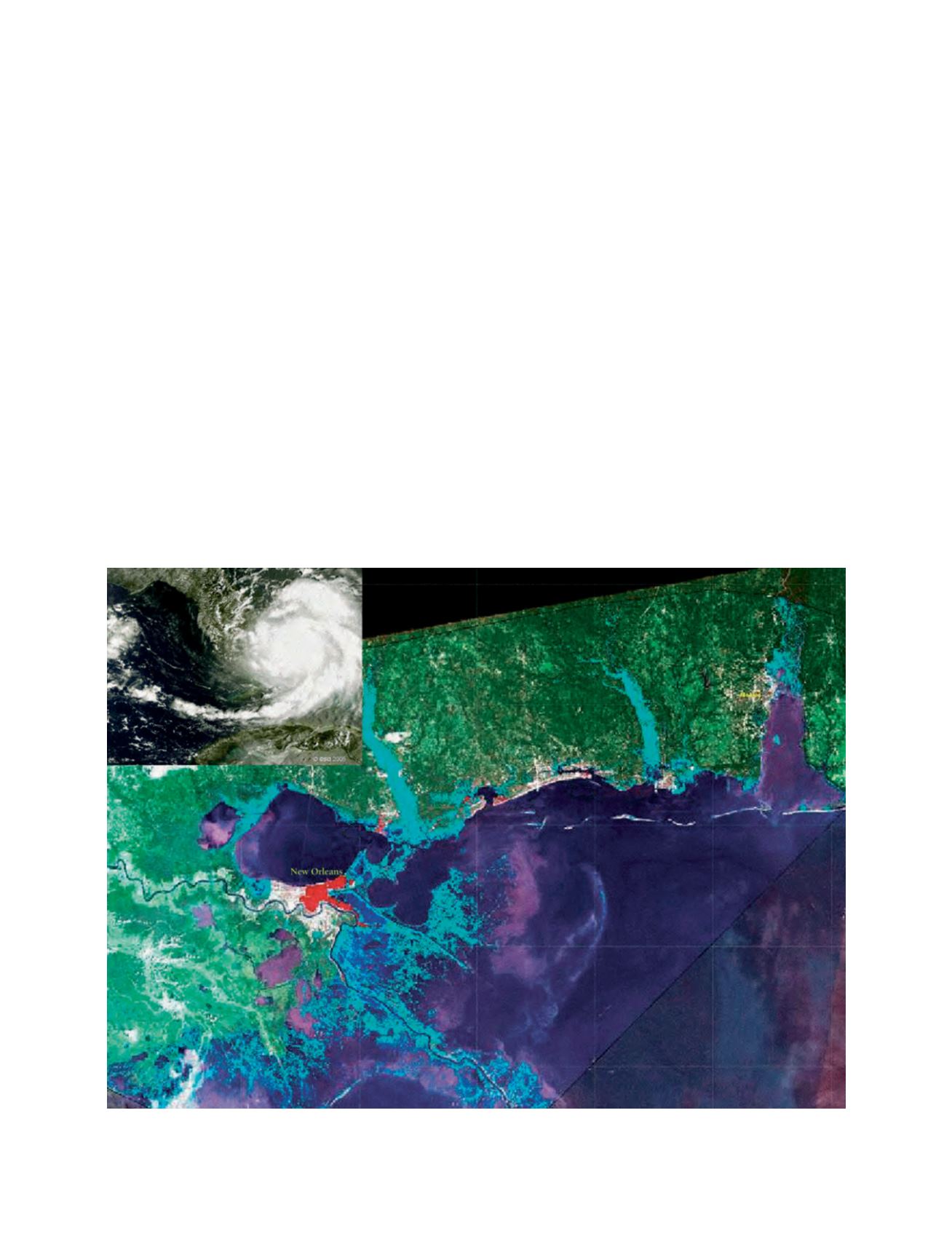
Event map of New Orleans in the aftermath of Hurricane Katrina, taken from NigeriaSAT-1, part of the DMC (inset, Hurricane Katrina taken from the
MERIS instrument aboard ENVISAT)
Image: DMCii; inset courtesy of ESA
by those associated with the theme is the establishment of a
global inventory of hazard maps and related data, again as part
of the GEO work plan. The executive bureau has created a free
software tool that will allow organizations to provide metadata
concerning their hazard maps at minimal effort; the hazard maps
themselves stay with the original organization in this distrib-
uted system. Metadata is now being populated into the system
and it will then be used to identify gaps in hazard map provi-
sion, as well as forming a valuable resource for use in disaster
management.
The UK has also provided an input to the UN Committee on
the Peaceful Uses of Outer Space (COPUOS) action team 7, and
the follow-on ad hoc group of experts on space and disaster
management, which has been identifying national and interna-
tional needs for space information in disaster management and
humanitarian relief with the goal of recommending how to coor-
dinate these assets globally in promoting better response to
events. The action team and the ad hoc group of experts have
reported their recommendations to UN-COPUOS and members
are working with the UN Office for Outer Space Affairs (UN-
OOSA) to review and scope an implementation pathway.
BNSC fully supports many activities in disaster reduction, and
will continue to focus its support in specific areas where UK
expertise and technology advancements can best be exploited
to achieve pragmatic outcomes for the wider community affected
by such disasters.
1