


 136 / 156

sector company. The instrument has significant in-flight
programmability in both the spectral and spatial domains, and
this has the advantage that it can mimic other sensors, such as
the SPOT and the Indian remote sensing (IRS) imagers, to
provide useful comparisons.
BNSC is a partner in the joint EC/ESA GMES initiative, which has
a well-established programme and action plan to develop relevant
operational capabilities by 2008. GMES is driven by the informa-
tion needs of Europe in the fields of environment and security.
Particular emphasis is given to matters of global change, environ-
mental stress, and natural and human-induced disasters.
Operational services are envisaged incorporating the advanced
technical and operational capabilities offered by terrestrial,
airborne and space-borne observation systems. Through ESA,
the UK is providing the lead in two of these important GMES
services: Terrafirma and Respond.
The Terrafirma initiative aims to provide a pan-European
ground motion hazard information service, to be distributed
throughout Europe via the national geological surveys. The service
uses the recently discovered power of satellite Radar
Interferometry (InSAR) technology to detect millimetric ground
level displacements in order to save lives, improve safety and
reduce economic loss (equivalent to approximately EUR3.5 billion
annual cost for ground movement effects in Europe). Initially, the
service focuses on urban subsidence, but it will eventually include
earthquake zones, landslides, coastlines and floodplains. Already
the service providers include 14 national geological surveys, with
more surveys keen to start working on the results.
From mapping the area coverage and magnitude of ground
motions following cataclysmic earthquakes, to measuring
discrete subsidence displacements over several years, satellite
InSAR has a wide variety of uses in ground movement surveying
applications. For several years now, the NPA Group, a UK-based
satellite mapping company, has been routinely detecting and
mapping to sub-centimetric levels in many types of large-area
ground motions using InSAR techniques. As well as heading
major research projects in this field for the ESA and the EC, NPA
is contracted to undertake this work, not only in the UK but
throughout the world, on behalf of local government agencies,
risk management companies, commercial organizations such as
mining companies, and geological survey institutions.
The Respond initiative aims to support the improved deploy-
ment of humanitarian relief through better understanding of
geographic information, supporting actions for both slow (e.g.
famine) and rapid (e.g. earthquake) onset crises. It is providing
high quality geographic information in consultation with users,
working within all phases of the crisis cycle – from prevention to
emergency response and from rehabilitation to the development
of long-term prevention plans. Additionally, the initiative provides
training and in-field support services for users, and supports fore-
casting and alerting services by providing maps of crisis areas.
Respond was very active during the Asian tsunami disaster and,
more recently, during the series of severe earthquakes (maximum
magnitude 7.6) that struck the Kashmir region in northwestern
Pakistan on 8 October 2005 (see map above). The Respond
consortium provided relief support to European and international
aid agencies by rapidly producing thematic, crisis and damage
maps based on satellite images, which were widely distributed.
The Centre for the Observation and Modelling of Earthquakes
and Tectonics (COMET) is one of the Natural Environmental
Research Council’s (NERC) centres of excellence and was estab-
lished to allow scientists to use satellite observations to model
the deformation of the Earth’s crust over periods ranging from
days to millions of years, and over areas ranging from tens to
thousands of kilometres. These models are used to study the
earthquake cycle, the effect of faulting and uplift on the Earth’s
surface, and the physics of continental deformation. These all
play an important role when quantifying seismic hazard and
interpreting how past environments control the distribution of
natural resources.
COMET uses various techniques, in conjunction with the data
from satellites, to model earthquakes and tectonics. These
[
] 136
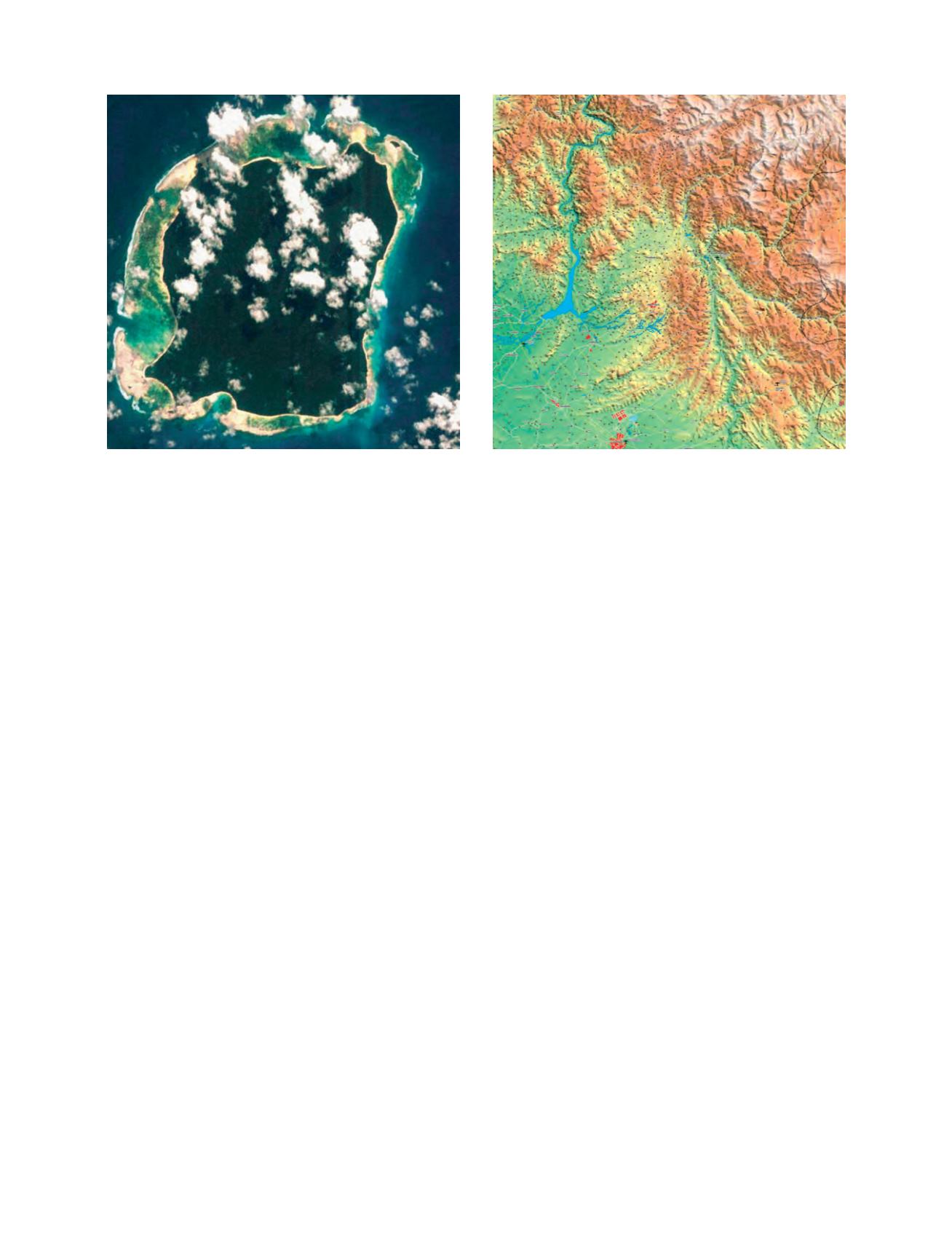
North Sentinel Island, taken 3 December 2005, showing the coral reef
raised out of the sea after the tsunami of December 2004 (picture taken
by the CHRIS instrument)
Image: ESA & SSTL
Map showing the extent of the potentially affected areas by the
earthquake of 8 October 2005. General overview maps were found very
useful due to their timely availability
Image: Infoterra Ltd.