


 133 / 156

[
] 133
S
HORTLY AFTER THE
tsunami of 26 December 2004, the
World Conference on Disaster Reduction held in Kobe,
Japan, confirmed the Yokohama strategy and adopted a
framework for action for 2005-2015. The Hyogo Framework for
Action sets priorities, in particular to “identify, assess and monitor
disaster risk” and to “use knowledge, innovation and education
to build a culture of safety and resilience”, to which space tech-
nologies in general and earth observation in particular should
contribute. There follow some concrete examples of the imple-
mentation of such priorities, which illustrates the uses of these
technologies.
Because of its sudden outset and immediate disastrous effects,
and because of the extent of the affected coastlines, the Asian
tsunami revealed to a wide audience how satellite data can
contribute to emergency and rescue operations. Since then, space-
derived information has been requested more than 36 times
through the International Charter: Space and Major Disasters.
Events addressed by such calls include Hurricane Katrina, the
2005 Kashmir earthquake and, most recently, the eruptive
episode of the Merapi volcano and the 2006 Java earthquake,
both in Indonesia. This sad list, and especially Hurricane Katrina,
recalls that no nation, regardless of its state of development, can
consider itself immune from or prepared enough for major disas-
ters. In spring 2006, heavy rains in central Europe caused the
rivers Elbe, Danube, Tisza and Dora to flood parts of Germany,
Austria, the Czech Republic, Slovakia, Hungary and Romania.
This led to four different activations of the charter, and the episode
represents the largest event mapped by the charter since the Asian
tsunami.
The need for an accurate and up-to-date picture of the situa-
tion for the management of emergencies is widely recognized,
but how does the wealth of data acquired day and night by
myriads of satellites contribute to reducing risks and vulnerabil-
ity? Part of the answer is provided by lessons learnt from
December 2003, when the waters of the Rhone river reached red
alert level for the first time, causing the failure of levees and very
serious flooding in the Rhone valley, southern France.
Thanks to the mechanism of the charter, a comprehensive set
of satellite imagery was acquired. In parallel, several aerial photog-
raphy campaigns were launched by national and local authorities.
A recent study
1
funded by the French Ministry of Ecology and
Sustainable Development compared various types of satellite
imagery with the aerial survey carried out by the National
Geographic Institute. Flood maps prepared during the emergency
had already proved to give valuable guidance to hydrologists for
their field assessment work. The point was to assess whether
satellite imagery could be used to characterize the flood event.
One of the most remarkable results of this study is its demon-
stration of the ability to detect hydrological objects equally on
aerial photographs and very high-resolution satellite pictures.
Beyond the simple detection of flooded areas, such objects
include features such as hydrological sectors, or water retention
boxes within the main waterbed, and through detailed analysis of
water turbidity, water circulation currents within and between
sectors. The effects of levee breaks could be observed as accu-
rately on satellite images as on aerial photographs, despite the
difference in resolution (1 metre vs. 0.3 metres). Therefore satel-
lite images contribute to regulatory tasks such as the revision of
flood atlases, and eventually to regulatory flood risk maps. It has
to be noted that a similar approach was independently taken by
the US administration after Hurricane Katrina.
Effective risk reduction through
monitoring of the environment from space
Jérôme Béquignon, Programme Co-ordinator, European Space Agency
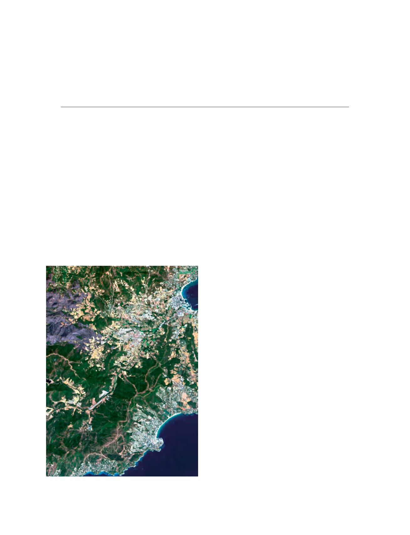
A CHRIS/PROBA image of France’s Var region showing fire scarring west
of the town of Cogolin. Acquired 3 September 2003
Image: SIRA through ESA 2005