


 141 / 156

acterization and continuous streamflow predictions are all impor-
tant areas that must be addressed in any water resources
sustainable development plan. Similarly, reservoir and water distri-
bution systems are critical aspects of any comprehensive scheme.
Another example is sustainable management of ground water.
Many water-scarce regions of the world rely heavily on ground-
water for both drinking water and agriculture. Thus, the
availability, sustainability and quality of groundwater are of vital
importance to these economies. All of these can be implemented
using satellite data and model data products, either solely or to
augment traditional hydrologic data, with appropriate DSTs.
Wildfires
Large fires occur in many vegetated landscapes across the world,
and may be ignited by lightning, accident, or deliberately either in
arson or for purposeful agricultural uses. Regardless of origin, fires
are formidable agents of disaster, voraciously consuming natural
and man-made resources and concurrently emitting particulate and
gaseous pollutants into the atmosphere. Remote sensing provides
a powerful means of fire monitoring and disaster mitigation for
sustainability. Earlier fire remote-sensing activities were limited to
identifying fire locations, because the sensors used were easily satu-
rated by strong signals from large or intense fires. With the enhanced
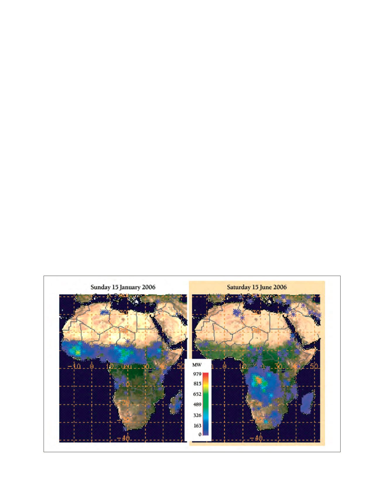
radiometric range of the fire channel on the Moderate Resolution
Imaging Spectroradiometer (MODIS) sensor aboard the EOS Terra
and Aqua Satellites, it is now possible to measure from space the rate
of release of fire radiative energy (FRE) associated with remotely-
sensed fires at 1km spatial resolution globally four times a day.
FRE is a powerful parameter that is well correlated with the
amount of biomass burned and the amount of smoke emitted,
and can be used to derive these quantities shortly after it is
measured. In addition, the Spinning Enhanced Visible and Infra-
Red Imager (SEVIRI) sensor aboard the Meteosat Second
Generation (MSG) satellite covering Africa and Europe, is now
able to measure FRE at 4km spatial resolution every 15 minutes.
NASA scientists working on the remote sensing of fires and emis-
sions are now collaborating with their European colleagues to
combine the advantages offered by NASA satellites and the MSG
to monitor biomass burning and smoke emissions in Africa, and
to make the results available to scientists and the community.
NASA’s role in building sustainability on a global scale is an
important mission of the US. The African continent has specific
needs that can be met by NASA data and model products. The
process of infusing this knowledge into Africa is underway in
collaboration with the international community, WSSD and CEOS.
Building sustainability for developing countries requires an inte-
grated systems approach, an integrated observing system, reliable
models, and adequate decision-support systems. Once we have
received inputs to our in-house inventory, we will use the infor-
mation to achieve the following goals:
• Document and communicate current efforts to use Earth
observation data for sustainable development in the devel-
oping world, particularly in Africa
• Provide an initial evaluation for each DST identified which
supports sustainable development in Africa and which may
benefit from use of NASA research results
• Provide recommendations for future funding activities, espe-
cially regarding evaluation, verification and validation,
benchmarking, gap analysis and transition to operational
activities.
We can then develop the environmental data and products that
can feed the African people with the knowledge and tools to make
better decisions for societal benefit.
1
[
] 141
Rate of release of fire radiative energy measured by Aqua-MODIS over Africa
Source: NASA GSFC Earth Science Divison