


 79 / 168

[
] 79
A sudden out-gassing of CO
2
occurred from Lake
Nyos on 21 August 1986, when a limnic eruption trig-
gered the sudden release of about 1.6 million tonnes
of CO
2
; this cloud rose at nearly 100 kilometres per
hour. The gas spilled over the northern lip of the lake
into a valley running roughly east-west from Cha to
Subum, and then rushed down two valleys branching
off it to the north, displacing all the air and suffocating
some 1,700 people – mostly rural villagers – within
25 kilometres of the lake, as well as 3,500 livestock.
1
As at May 1987, there was about 26 per cent build-up
of CO
2
and scientific findings in 1991 show that Lake
Nyos now poses an even greater threat to thousands
more people than before, because it is being recharged
with deadly CO
2
.
The dam at the northern end of the lake has obviously
receded since its formation some 400 years ago. The
area surrounding the lake shows traces of nearly vertical
landslides and rock falls. In addition, in the downstream
of the dam, old and recent landslides can be identified.
There are even indications that landslides will occur at
the section of the dam just east of the spillway.
The collapse of the dam would result into the release
of water at an estimated peak discharge of 17,000
cubic metres per second into the Kumbi River, and
discharge into the Katsina-Ala River in Benue State,
Nigeria. About 50 million cubic metres of water would
flow downhill, flooding the Northwest Province of
Cameroon and seven frontline States in Nigeria –
Taraba, Benue, Kogi, Adamawa, Akwa-Ibom, Cross
River and Anambra.
These massive floods would, in a matter of minutes,
submerge and swep through Katsina-Ala in Benue
State, as it hurried into the Benue River and Makurdi,
100 kilometres away. Within a few hours it would be
felt in Lokoja, Asaba and Onitsha. The destructive
impact of the flood would put thousands of lives at
risk, and over 20,000 herds of cattle and other live-
stock and 15,000 hectares of arable land would perish.
The estimated financial loss would be in billions,
comprising crops, residential and commercial struc-
tures, utilities and infrastructures including roads,
bridges and other services.
A lot of degassing activities have been ongoing to
prevent the occurrence of toxic gas release from the
lake. However, it is believed that CO
2
is building up
in the lake so quickly that it raises the risk of a new
catastrophic release.
If the dam breaks, the gas would spill from the
upper section of about 40 metres of the lake down-
ward to the region inhabited by hundreds of people.
In effect, Lake Nyos and its neighbourhood is still a
disaster zone, given the evidence of human activities
and the presence of farms, houses and cattle-rearing
around the lake.
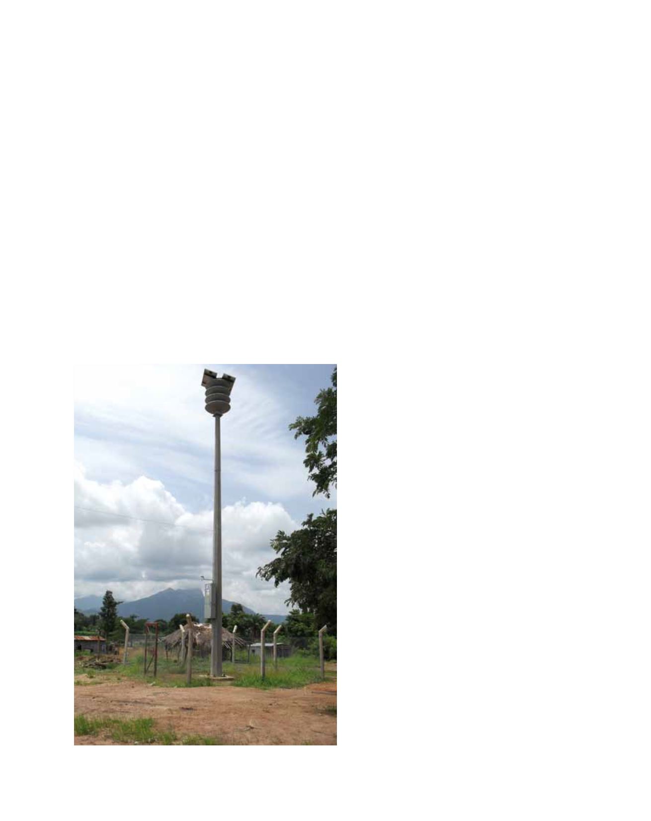
NEMA has acquired and installed early warning equip-
ment that will give an alarm to warn the communities
around the lake to move before the release of poisonous
flood water into River Katsina-Ala and othe tributaries.
Early warning systems for Lake Nyos
Lake Nyos is a crater lake in the Northwest region of Cameroon,
located about 322 kilometres north-west of Yaounde and about
436 kilometres south-east of Abuja in Nigeria. It lies on latitude
6°26’17’’N and longitude 10°17’56’’E. It is a deep lake, high on
the flank of an inactive volcano in the Oku volcanic plain; a zone
of crustal weakness and volcanism that extends to the south west
through the Mount Cameroon stratovolcano. The lake covers an
area of about 1.5 square kilometres, with a surface elevation of
1,091 metres and a depth of 208-210 metres. Its volume of water
is 132 million cubic metres, with a dam length of 50 metres. The
lake is compositionally stratified, with a 200-metre deep fresh
water area in the upper 50 metres and heavier sodium and carbon
dioxide (CO
2
) rich water below that. The water below 180 metres
is particularly rich in sodium and CO
2
. Most of the sodium and
CO
2
come from numerous sodium-bicarbonate bearing springs –
derived from an underlying magma chamber – feeding into the
bottom of the lake.
The dam wall of Lake Nyos consists of very poorly consolidated
pyroclastic layers of gravel, rock and mountainous soils and is
subject to erosion from rain, wind and the lake waters. This region
has an average rainfall of 2.5 metres each year. A natural dam of
volcanic rock hems the lake waters.
Flood early warning equipment
Image: NEMA 2010