


 80 / 168

[
] 80
Integrated disaster risk reduction
in the Southeast Asian region
Dato’ Ibrahim Bin Komoo, Southeast Asian Disaster Prevention
Research Institute, Universiti Kebangsaan, Malaysia
S
outheast Asia is one of the most vulnerable parts of the
world to natural disaster. The region is frequently exposed
to hazards due to geological processes such as earthquakes,
tsunamis, volcanic eruptions and landslides, and climatic hazards
such as floods, droughts, typhoons and storms. Natural disaster
is the main contributing factor to the high level of casualties and
property damage in many countries, which have yet to implement
appropriate disaster risk reduction (DRR) strategies.
The Southeast Asia Disaster Prevention Research Institute
(SEADPRI), established by Universiti Kebangsaan, Malaysia in 2008,
focuses on initiatives for integrating the management of DRR via
research in the Southeast Asia region. Its aims are to lead innova-
tive knowledge transfer on holistic disaster prevention in the region
and to research issues related to science and governance for DRR.
Multidisciplinary research programmes in disaster management and
DRR are conducted to expand knowledge of climatic, geological and
technological hazards. Training of human capital is also a primary
focus, particularly in addressing disaster issues for both the public
and private sectors through postgraduate programmes.
Information gathered by SEADPRI shows that a
variety of natural disasters have taken a cumulative
toll on countries across the region in recent years.
Significant disasters recorded in the Southeast Asia
region are as follows:
Earthquake and tsunami
Earthquake is the major geological hazard in Southeast
Asia. The region is the most tectonically active zone on
earth as the lithospheric plate is crushed between three
major subducting oceanic plates, namely the eastward-
moving Indian Ocean Crust, the westward-moving
Philippines Sea Plate and Pacific Plate and the north-
ward-moving Australian Plate, squeezed northwards
towards the Eurasian Plate. Collisions along these
boundaries have caused enormous earthquake events.
Several large-scale earthquakes have triggered tsunamis,
which lead to high levels of risk particularly to coastal
areas in Indonesia and the Philippines.
The North Sumatra earthquake that took place in
2004 with a magnitude of 9.3, followed by a tsunami,
was a critical lesson for countries in Southeast Asia,
revealing that most of these countries were still unpre-
pared to face major natural disasters. Deaths due
to the tsunami in the affected countries were very
high: 165,708 in Indonesia, 8,345 in Thailand, 80 in
Malaysia, 61 in Myanmar, 35,222 in Sri Lanka and
12,405 in India. The events highlighted several basic
weaknesses in the region, particularly in terms of the
lack of infrastructure, emergency response, prepared-
ness and public awareness.
Such gigantic seismically triggered tsunamis events
have caused catastrophic consequences in terms of
the number of people killed – for example in 1992 in
Flores, Indonesia (2,200 deaths), in 1990 in Luzon
(1,621 deaths), in 1998 in Papua New Guinea (2,183
deaths), in 2004 in Indonesia (227,898 people killed
and about 1.7 million people displaced), and in 2005
Northern Sumatra (1,000 people killed). Earthquakes
also trigger landslides. On the coast of Padang after
the Sumatra earthquake (2009), several villages slid
into the valley after the quake, killing 1,117 people
and injuring 1,214. There was damage to 181,665
buildings and 451,000 people were displaced in the
Padang-Pariaman area.
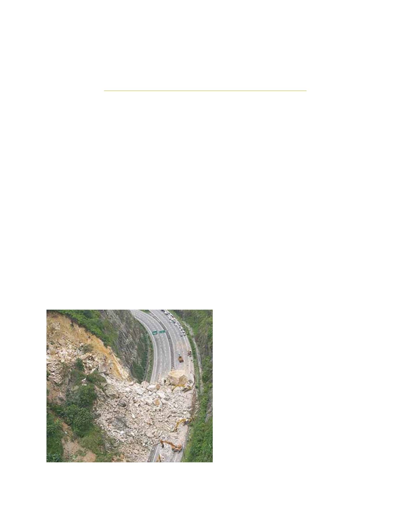
2001
Rockfall along the main highway near Kuala Lumpur. Landslides on man-made
slopes are the most common hazards for the Southeast Asia region
Image: SEADPRI