


 147 / 196

[
] 145
Users can contact UNOSAT via the 24/7 hotline to request rapid
mapping services, or to be included in the mailing lists that are
created during each emergency.
Humanitarian satellite mapping is now widely used in the field,
with varying degrees of efficiency. In some cases, the driving force is
still a push by the space community to show that satellites are a social
benefit in humanitarian situations. As users begin to integrate space
solutions into their routines, equilibrium tends to be restored, with
demand creating the offer, rather than vice-versa. This process is
normal, and it has characterized several episodes in the history of
integrating technological solutions into practice in the international
development and cooperation field.
As in previous cases, the UN system has been applied with caution,
taking the time to understand the advantages brought about by tech-
nological innovation, test them and absorb the relevant practices
gradually. A large number of space applications are emanating from
the private sector, which constitute up-to-date use of the underpin-
ning technology but are not tailored to the requirements of the UN
family. Although many satellite programmes have adopted labels indi-
cating that they are ‘user-driven’, it is nonetheless a reality that the
whole data procurement sector is driven by commercial considera-
tions. The response to this should be one of constructive collaboration
between the UN and the private/public sector, not one of closure. The
policy should not be one of entrusting to the space sector the entire
responsibility of creating solutions for the international community.
The space sector has strong scientific and engineering components,
and it is not always easy on these levels to think in terms of benefi-
ciaries at the local scale. For the UN this is an imperative. The case of
the International Charter ‘Space and Major Disasters’ (Space Charter)
is a good example of how the relationship between the space commu-
nity and the UN can evolve from experimenting to supporting
operations in the field. It has recognized that each party has its own
role and accountabilities, and that intermediaries like UNOSAT and
humanitarian users in the field occupy a specific position in the infor-
mation chain which must be respected and leveraged if one wants
results, not merely promotion. The Space Charter experience shows
that the use of space solutions can grow exponentially if
the right players are involved.
The next step to take is to combine ‘user-driven’ with
‘need-based’. The needs of users are not sufficiently
considered today. They are mostly known only in disas-
ter management and humanitarian circles. It is almost
impossible in a policy report to translate the needs arising
from humanitarian coordination and relief distribution
on the ground. This is why we keep a stringent need-
based approach in our work, in parallel with relying on
a number of partners from public and private sectors,
including the European Centre for High Energy Physics
(CERN), which hosts the UNOSAT operations and train-
ing centre. Our partners are vital to ensure that our
colleagues in the field can carry out their mission, and
that local communities and authorities can gain access
to knowledge and solutions they know how to use.
UNOSAT can respond to specific user requests with
dedicated solutions. Alternatively, a number of typical
support services are available:
• Satellite imagery search and procurement assistance
• Image processing
• Map production, including information extraction
and analysis
• Research and methodology (design and guidance)
• Field and remote technical assistance, including
strategic consulting
• Field verification and data collection
• Training and capacity development
• Integrated satcoms solutions
• Data storage and information and communications
technology (ICT) solutions.
The views expressed in this article are those of the authors
and do not represent any position attributable to the UN
organization.
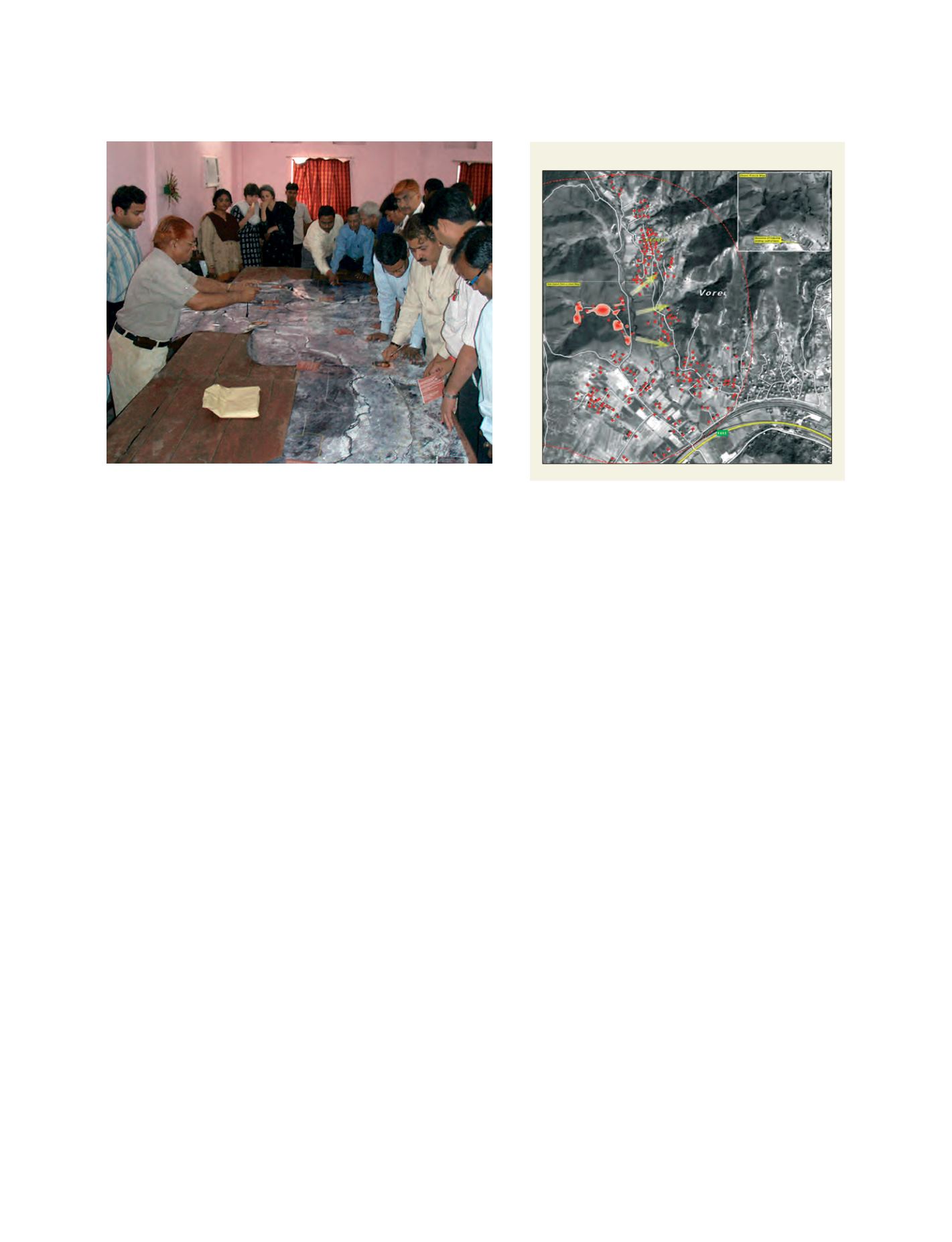
Satellite analysis of an ammunition explosion in Albania
Source: UNOSAT
Participatory mapping using satellite imagery to plan a
polio vaccination campaign, India
Image: WHO