


 144 / 196

[
] 142
Between human security and disaster
management – the role of satellite derived
information in achieving the goals of
the international community
Francesco Pisano and Einar Bjorgo, UNITAR/UNOSAT
W
hat is the role of satellite applications in achieving the
goals and objectives of the United Nations (UN) and
the international community? One of great and
increasing support, bringing advanced technology to bear for the
benefit of all and relying on objective data to produce updata-
ble information.
Earth observation data and geographic information systems (GIS)
are useful tools for effective decision-making. The environment,
human security, vulnerability reduction, adaptation to climate
change, emergency response and recovery are all areas in which these
tools are becoming common requirements, and their effects on
current practices are already established.
For developing countries in particular, with relatively
poor territorial documentation and outdated maps,
routinely acquired satellite imagery combined with local
field surveys can be invaluable information sources. Local
institutions, for example, can run analyses on the
geophysical risks facing their communities, and develop
plans for improved urban and rural territorial manage-
ment. Time-stamping the environmental situation at
certain intervals allows monitoring of environmental
parameters, such as forest cover and urban expansion.
UNOSAT is dedicated to developing and applying,
together with an ever-growing number of partners, the
entire range of satellite solutions to all UN goals and
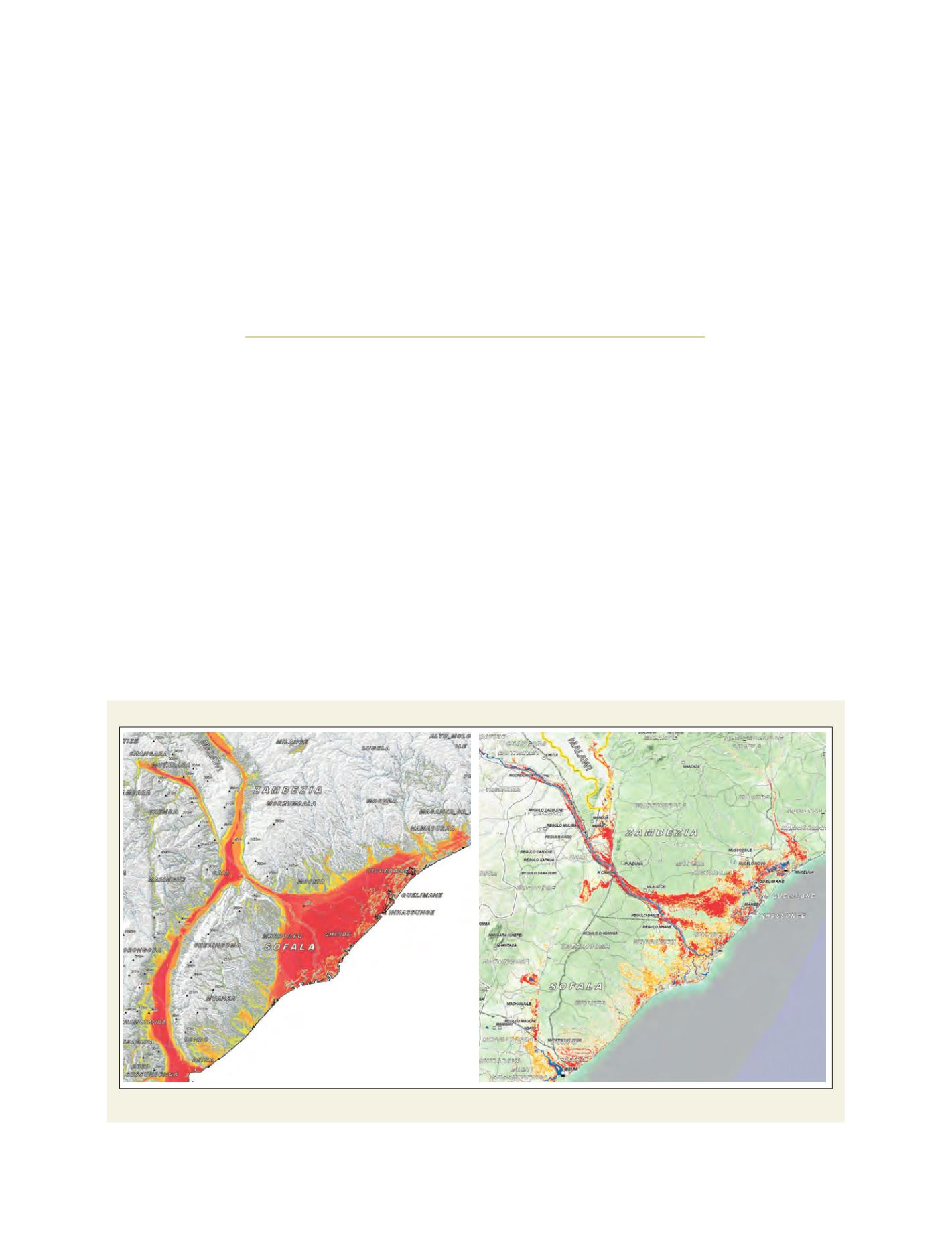
Mozambique delta
Left: Potential risk area for floods in Mozambique delta; Right: Satellite-observed flooding
Source: UNOSAT