


 131 / 196

[
] 129
Environmental management measures
for tsunami-affected areas of Cuddalore district,
Tamil Nadu, India: reconstruction,
resettlement and future community resilience
Dr Meenakshi Dhote, Department of Environmental Planning, School of Planning and Architecture, New Delhi, India
A
t 08:00 local time on 26 December 2004 a titanic shift of
tectonic plates triggered an earthquake of immense magni-
tude (9.0 on the Richter scale) in the Indian Ocean, 250
kilometres from the west coast of Sumatra, Indonesia. The result
was a massive tsunami that raced across the Indian Ocean devas-
tating coastal areas in Thailand, Malaysia, Indonesia, Sri Lanka
and India. The effects were felt as far away as the east coast of
Africa.
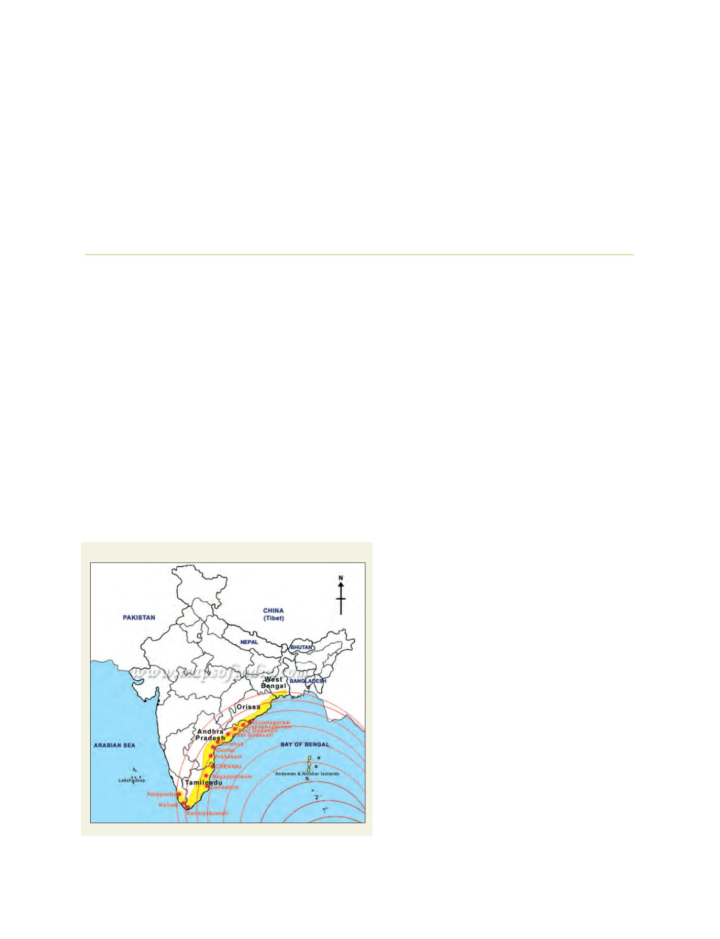
India suffered major setbacks due to the tsunami. The waves caused
extensive damage to areas of South India including the Union
Territories of the Andaman and Nicobar Islands and Pondicherry;
and coastal districts of Tamil Nadu, Kerala and Andhra Pradesh.
As the survivors along the coasts devastated by the
tsunami started to clear the debris, the attention of the
world turned to how these communities were going to
rebuild their towns and villages. When the unthinkable
happens again, will they be any better prepared?
Our concern
A multidisciplinary group consisting of students from
the departments of Environmental Planning and
Landscape Architecture at the School of Planning and
Architecture, New Delhi; and the Master of Planning and
Landscape Architecture, School of Architecture and
Planning, Chennai, Tamil Nadu, undertook a study of
the tsunami-affected areas of Cuddalore district in Tamil
Nadu, India. The study was conducted about two months
after the disaster, the trauma weighing heavily on the
affected area; with the impact on the landforms and vege-
tation showcasing the fury of nature. It reinforced our
determination to suggest long-term approaches to reduc-
ing the vulnerability of such areas in similar situations
in the future.
The aim of the study was to evolve environment
management measures for the tsunami-affected areas of
Cuddalore district. This was achieved by carrying out a
survey of the selected coastal belt of the district. The
impact of the tsunami on the coastal belt was recorded
and analysed. The study also attempted to validate the
provisions of Coastal Regulation Zone (CRZ) notifica-
tion of the Government of India and its adaptability, as
a response to the context. The management measures
tried to formulate a strategy to reduce vulnerability and
achieve safe conditions in the study area.
The study area
The study area was limited to a distance of one kilometre
from the high tide line, which took into consideration the
portion where the water had penetrated inland. The settle-
ment and landscape features along the entire 57.5 kilometre
stretchwere mapped and recorded during the intensive field
survey covering around 26 coastal settlements.
The tsunami hits eastern and southern coastal India
Source: Environmental management measures; Cuddalore District: Studio Report,
Department of Environmental Planning, School of Planning and Architecture, May 2005