


 66 / 208

[
] 66
Sustainability research using spatially
explicit land-use change scenarios
Yoshiki Yamagata, Centre for Global Environmental Research, National Institute for Environmental Studies, Tsukuba, Japan
C
limate change prediction scenarios form the scientific
foundation when considering global warming counter-
measures. Detailed spatial interactions between climate
change predictions and socioeconomic changes have yet to be
analysed in Intergovernmental Panel on Climate Change (IPCC)
assessment reports. Socioeconomic scenarios dividing the world
into different political units such as the USA and the EU (using
a different integrated assessment model than that used in this
study) have been used for prediction. However, future considera-
tion of a sustainable low-carbon society will require the use of
climate prediction models of greater spatial resolution to analyse
global warming mitigation and adaptation for specific land uses.
In our research, we have sought to develop geographical land use,
land-use change and forestry (LULUCF) scenarios on a scale of
50 km suitable for the IPCC Fifth Assessment Report.
Global warming impact assessment
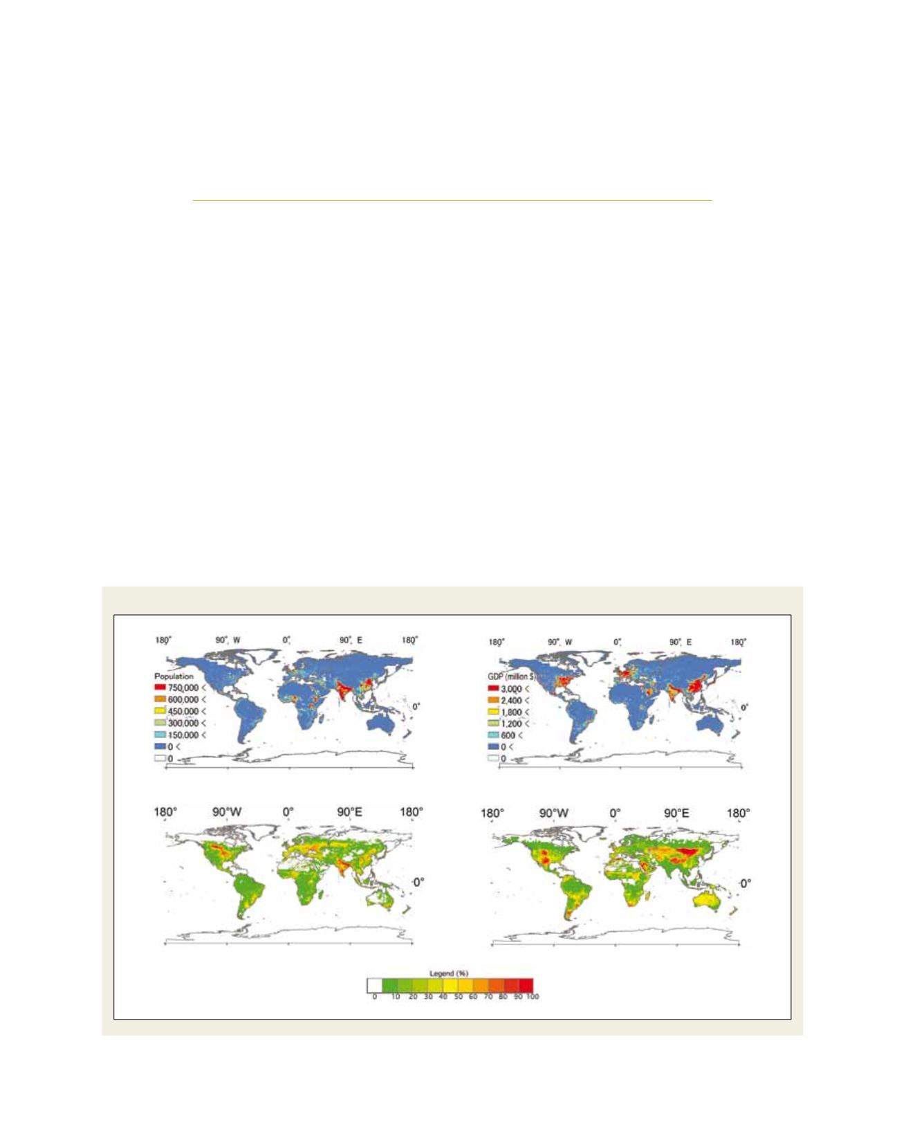
We have developed a new method for downscal-
ing the population, GDP, changes in land use (e.g.
pasture land, cropland and cities) and other data
generated by country-specific socioeconomic models,
to a 0.5° mesh (approx. 50 km spatial grid data). As
a means of allocating land use to each cell of the
mesh within a country, we used land cover clas-
sification maps created from 1 km mesh satellite
images to estimate urban growth, then a crop and
forest productivity model which estimated changes
in cropland and other land uses accompanying urban
growth, and allocated those changes to the mesh as
land use required for agriculture and forestry produc-
tion in each country, up to the year 2050. Our results
E
nvironment
:
air
,
water
,
oceans
,
climate
change
Distribution of population, GDP, cropland, and pasture land in 2050
Source: NIES
Population
Cropland
GDP
Pasture land