


 67 / 208

[
] 67
E
nvironment
:
air
,
water
,
oceans
,
climate
change
differences in anthropogenic heat emissions from
housing, offices, transport and other human activi-
ties, as well as changes in green space ratio, building
density, and other land-use attributes. We are using
these scenarios in urban climate model research to
analyse heat island effects caused by future changes
in land use.
The use of these spatially explicit land-use scenarios
not only enables us to make more precise predictions of
both global and regional climate change, but to facilitate
assessment of climate change impacts at the regional
level and consideration of adaptation measures.
Carbon cycle feedback
Changes in land use are second only to the use of fossil
fuels as a source of human-induced CO
2
emissions.
We now realize that converting natural vegetation into
cropland or pasture land causes changes in the physical
environment of the surface layer, which affects climate.
We used a land-use change scenario prepared for the
IPCC Fifth Assessment Report to analyse alterations to
CO
2
emissions caused by future changes in land use
(such as reductions in forest cover). Using a terres-
trial ecosystem model that simulates the movement
of carbon through processes such as photosynthe-
sis and transpiration of plants and decomposition by
soil microorganisms, we have assessed CO
2
emis-
sions resulting from deforestation and logging, and
CO
2
absorption by resurgent growth of vegetation on
abandoned arable land. This showed that the impact of
increases or decreases on forest vegetation (different for
each scenario) in the global carbon cycle is larger than
we had estimated.
Land-use scenarios were analysed to estimate the
cumulative carbon emissions derived from changes in
land use relating to scenarios being considered under
IPCC RCPs to stabilize the concentration of CO
2
in
the atmosphere by the end of the twenty-first century.
Our findings revealed a marked difference between
integrated assessment model emission scenarios and
two RCP scenarios in particular from 2006-2100 –
RCP 2.6 (CO
2
concentration of approx. 450 ppm) and
RCP 4.5 (CO
2
concentration of approx. 550 ppm).
RCP 2.6 shows an increase in the area of agricultural
land to realize low-carbon scenarios through large-
scale biomass energy use, while RCP 4.5 predicts
CO
2
absorption through large-scale reforestation and
reduction of the cropland and pasture land area by
introducing a price for global greenhouse gas emis-
sions. The large impact of increases and decreases
in forest cover on the carbon cycle brought about
by these scenarios is responsible for the discrepan-
cies from the integrated assessment model emissions
scenarios.
Since global low-carbon scenarios being used by
the IPCC and elsewhere, do not consider carbon
cycle feedback related to changes in land use, our
results pinpoint the need to combine land-use change
scenarios with terrestrial ecosystems and climate
showed that the population and GDP of Asian cities would grow
markedly and this would, in turn, change the global distribu-
tion of cropland and pasture land. As one of the Representative
Concentration Pathways (RCPs) being covered in the IPCC
Fifth Assessment Report, our findings are being used to predict
worldwide climate change. Along with downscaling global scale
scenarios in this way, we developed spatially explicit land-use
change scenarios specific to certain localities. A newly developed
urban economic model was used to construct a scenario for land
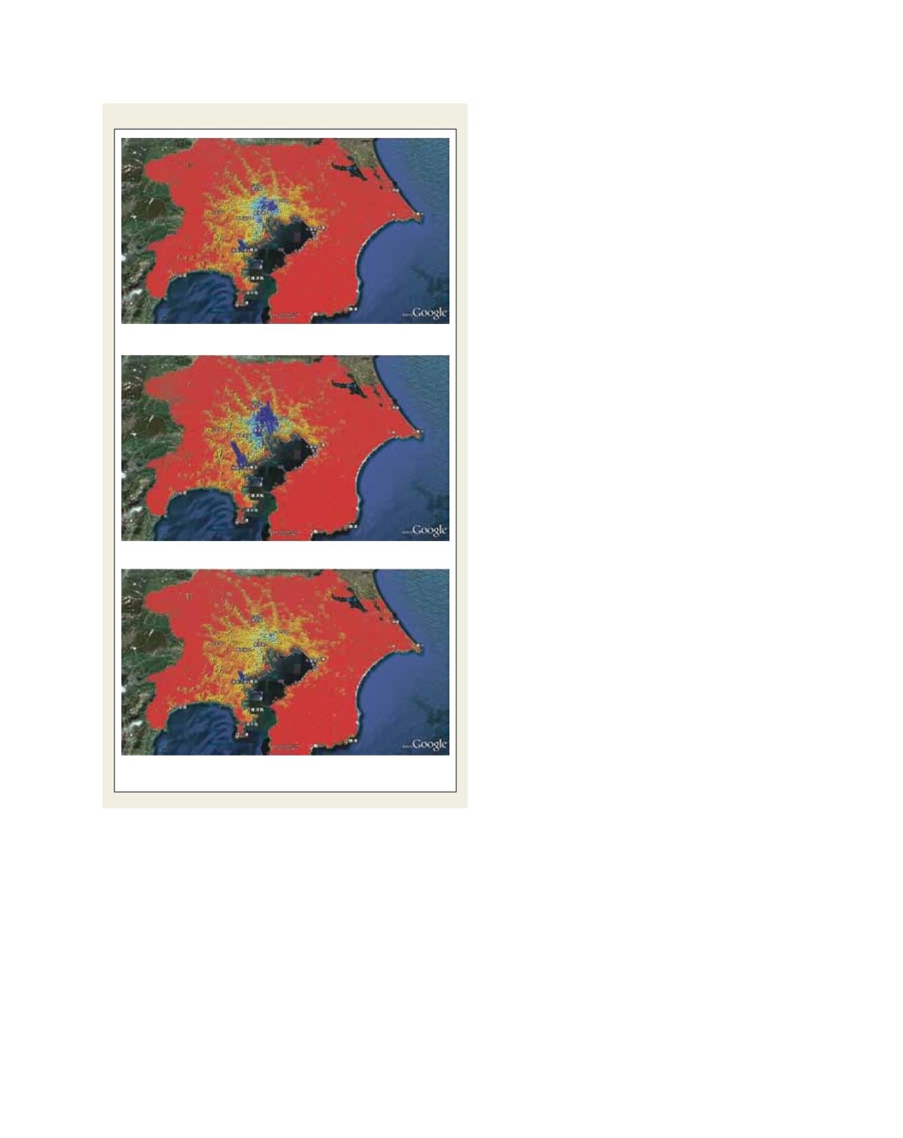
and building markets in the Tokyo Metropolitan Area. Depicting
socioeconomic changes in terms of either population centrali-
zation (compact city) or dispersion (sprawl), we predicted
Distribution of population in the Tokyo Metropolitan Area
Source: NIES
Compact city
Dispersed city
BAU scenario