


 138 / 196

[
] 136
United Nations International Strategy for Disaster
Reduction (ISDR). It is also aligning its efforts with the
Hyogo Framework for Disaster Risk Reduction, which
is defining and promoting the multi-hazard risk-
management approach.
Other key partners include the World Meteorological
Organization, which is initiating a disaster risk reduction
programme; the Committee on Earth Observation
Satellites, which supports the use of satellites for risk
management; the Intergovernmental Oceanographic
Commission, which promotes tsunami early warning
systems; and the United Nations Office for Outer Space
Affairs, which is implementing the UN Platform for
Space-based Information for Disaster Management and
Emergency Response. GEO is also working with the
humanitarian aid community led by the United Nations
Office for the Coordination of Humanitarian Affairs.
In the longer term, effective disaster risk management
and reduction will require using Earth observations to
better understand the relationship between natural disas-
ters and sustainable development. For example,
increasingly dense urban populations, emerging health
threats and the impacts of climate change are generating
new types of hazards and magnifying existing ones.
Integrating information to improve forecasts on climate,
health, water, disasters and other fields addressed by
GEOSS will therefore be increasingly important for both
sustainable development planning and disaster risk
management.
1
ing system on the continent. The system combines spectral data from
satellite-based sensors with observations from a geostationary
weather satellite. Once a fire is detected, e-mail and SMS text
messages are immediately sent to the affected parties. Future plans
include adding tools for managing fire risks.
Monitoring regional risks through SERVIR and Sentinel Asia
– By
improving the speed and accuracy of information for disaster
preparedness and early warning, these two regional services aim to
minimize deaths and socioeconomic losses resulting from disasters.
Sentinel Asia has been established by 44 space agencies and disaster
management agencies from 18 Asia-Pacific countries together with
seven international organizations. It uses remote sensing and
Geographic Information Systems (GIS) technologies to monitor all
of the major kinds of risk facing the region. Similarly, SERVIR enables
Central American countries to access satellite imagery, geospatial
data and interactive online tools to address a wide range of needs. It
monitors weather, forest fires and ecological changes, as well as
extreme events such as red tides, tropical storms and floods.
Meeting the cross-cutting needs of users
The Global Earth Observation System of Systems is being assembled
out of numerous national and regional systems. Existing national
and regional seismographic networks and early warning systems, for
example, are being coordinated and interlinked in order to form
coherent global networks. But because information is often needed
at the local, national or regional levels (as with the SERVIR and
Sentinel Asia examples above), GEOSS needs to be made relevant to
the users operating at these levels.
The success of GEOSS will depend on how actively users engage
with it. Given its scale and its cross-cutting nature, GEOSS must
simultaneously address the needs of a large variety of users, from
developed and developing countries, from the regional and global
levels, and from governmental departments and ministries, scien-
tific institutes, industry, and national and international organizations.
To ensure that GEOSS fully supports the needs of disaster
managers, GEO is coordinating its disaster-related activities with the
About GEO and GEOSS
The Group on Earth
Observations was established
in 2005 after the World
Summit on Sustainable
Development (WSSD), the
Group of Eight leading
industrialized countries (G8)
and three ministerial Earth
Observation Summits all called
for improving existing
observation systems. Its
membership now includes 73 countries and the European
Commission; 51 ‘participating organizations’ also contribute
to its work.
GEO is coordinating the construction of the GEOSS, which
will link together diverse monitoring networks, instruments,
databases and models and other decision-support tools.
GEOSS addresses nine priorities of critical importance to the
future of the human race. In this way, it aims to help countries
to protect themselves against natural and human-induced
disasters, understand the environmental sources of health
hazards, manage energy resources, respond to climate
change and its impacts, safeguard freshwater resources,
improve weather forecasts, manage ecosystems, promote
sustainable agriculture, and conserve biodiversity.
GEO also serves as an advocate for investments in disaster-
management and other Earth observation systems. Greater
investment is essential to ensure the adoption of new and
emerging technologies for monitoring land-use change, the
interaction between extreme weather events and other
aspects of the environment, and other variables that can
affect disasters and human well being.
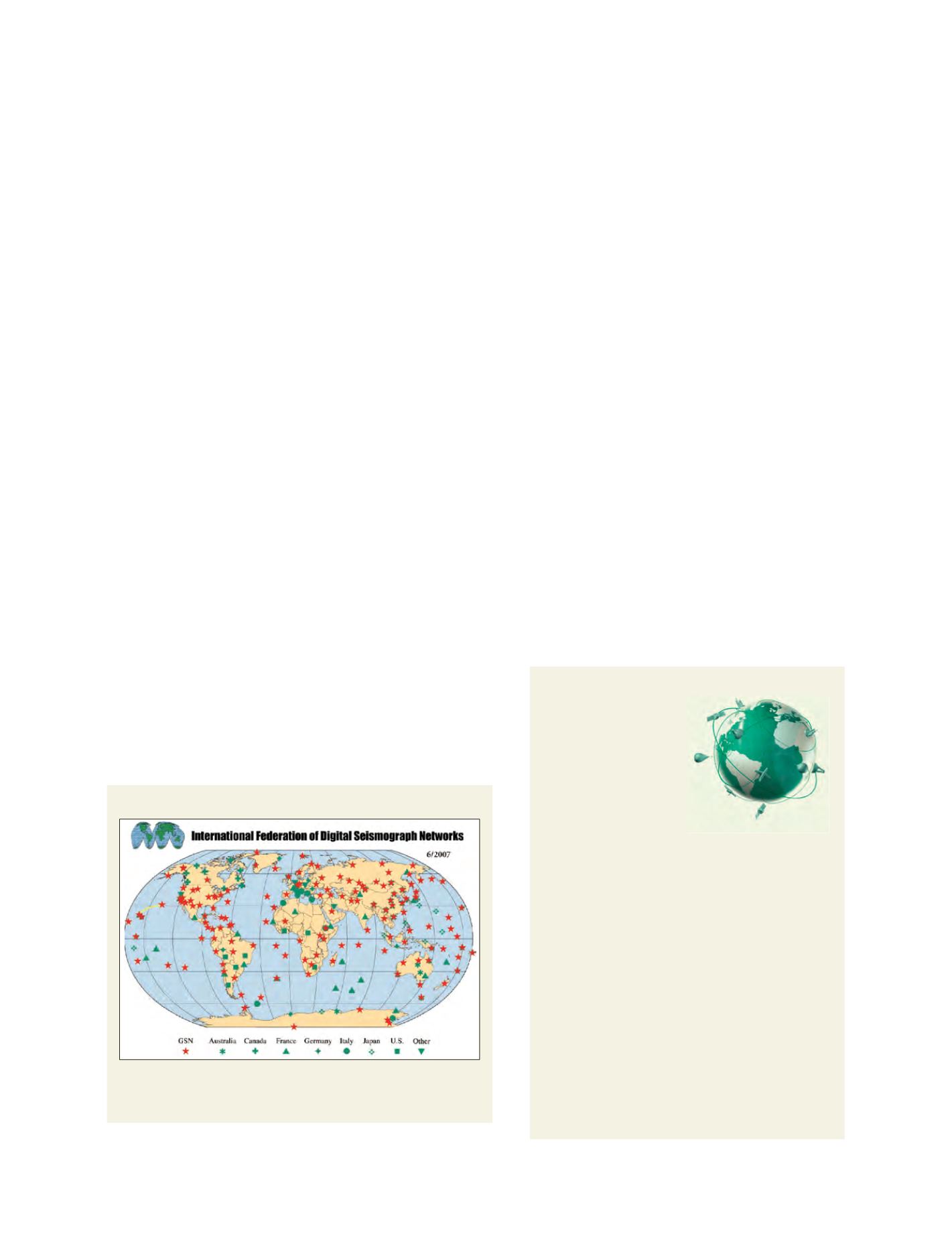
Geographic distribution of FDSN ‘Backbone’ stations
The FDSN ‘Backbone’ stations’ data are archived at the Data Management
Center of IRIS and distributed in real-time by FDSN members. The different
symbols indicate the different parent networks contributing the data
Annual mean
Source: Incorporated Research Institutions for Seismology (IRIS)